| Grafton to Camp Allegheny Tour / 188map
Photo by Linda Walcroft May 2007 www.CivilWarFieldtrips.com |
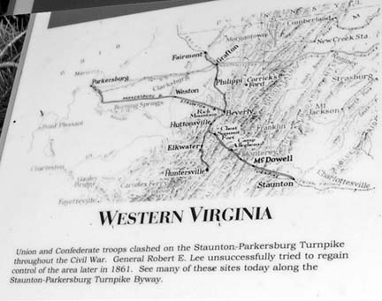
This turnpike connected the upper Shenandoah Valley with the Ohio River by 1847. Designed by master engineer Claudius Crozet, it was a major rock-paved roadway with toll stations. The road you are traveling follows the original turnpike route. Both armies struggled for control of this road in 1861. The Union victory at Rich Mountain secured much of Western Virginia and sustained a growing statehood movement. A 35th star was added to the flag in 1863 for West Virginia.